
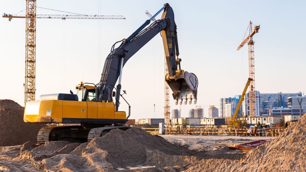
Infrastructure projects form the backbone of thriving communities, connecting people and businesses with the resources they need to live and grow. From roadway expansions to new water and sewage lines, these developments aim to enhance daily life and drive economic growth. Yet, hidden beneath the surface often lies a complex web of pipelines, power lines, communication cables, and other utilities that can complicate the construction process.
The challenge intensifies when engineering teams discover misaligned or intersecting utilities—often referred to as what we call “Utility conflicts”—which can cause unforeseen delays, accidents, and ballooning costs. The question is how to address these conflicts effectively and in a timely manner. As it turns out, artificial intelligence offers promising solutions. By combining AI-driven data analysis with robust mapping tools, project teams can effectively navigate underground infrastructure and avoid detrimental conflicts. This article explores the real impact of these utility conflicts, why they matter so much, and how AI mapping stands poised to transform the way we plan and execute infrastructure projects.
The Hidden World Beneath Our Feet
Infrastructure developments typically target what lies above ground: roads, buildings, railways, and bridges. However, the systems that make modern life possible—electric cables, sewer pipes, gas lines, and telecom wires—are hidden below the surface. When designing or upgrading structures on the surface, engineers must figure out precisely where these subterranean networks lie.
Problems arise when the location data for existing utilities is incomplete, inaccurate, or outdated. A pipeline that was plotted decades ago may have shifted position, or perhaps the record-keeping from a long-gone utility firm never accurately mapped out the route. In other cases, changes during past projects might not have been recorded in official databases. As a result, civil engineers may discover these utilities only when they physically dig into the ground.
Such discoveries can feel like stumbling into a minefield. Accidentally severing a gas line could lead to dangerous leaks or explosions, while cutting through power cables disrupts electricity, harming local communities and businesses. Each time a project is forced to pause to handle these unexpected conflicts, schedules falter, budgets swell, and team morale can deteriorate.
Real-World Impact of Utility Conflicts
A single infrastructure project involves multiple stages: design, planning, site surveys, bidding, and then actual construction. At any point in this process, encountering hidden utilities can send ripples through the entire plan. Each utility conflict might necessitate rerouting the design or changing the foundation structure. These changes can spark contractual disputes, especially if no one anticipated the extra labor and materials needed to fix the issue.
In the worst scenarios, utilities that remain undiscovered until the latter stages of a project become full-blown crises. Large-scale water pipeline damage can flood a site, halting work for weeks. Accidentally severing fiber-optic cables may cut off internet access to thousands of residents or businesses, eroding public trust and forcing immediate emergency repairs. Such incidents impact not just the project’s timeline and costs but also the community’s perception of the organizations overseeing the work.
The financial consequences are staggering. According to various industry surveys, utility conflicts are a leading cause of unplanned change orders and cost overruns in infrastructure projects. Even a single major conflict can add significantly to expenses, requiring extra manpower, specialized equipment, or indemnification for damages. A quote from a field specialist underscores this point: “Every unforeseen utility conflict can set a project back by weeks if not months, while budgets inflate well beyond initial estimates.” Undoubtedly, avoiding these disruptions should be a priority for any engineering firm.
Origins of Utility Conflicts
When investigating why these conflicts keep cropping up, the issues can often be traced to:
- Inaccurate or Outdated Records: Many utility owners do not have modern, digital records. Some rely on paper maps that date back decades, if not longer.
- Fragmented Oversight: Infrastructure is divided among numerous stakeholders, from city departments to private utility companies. Disjointed coordination hinders data sharing.
- Land Use Changes: Over time, land usage evolves, with new housing developments or commercial expansions built on the ground once used for different utilities.
- Human Error: Simple mistakes or oversights during site assessments or prior construction can lead to false assumptions in the present day.

Collectively, these factors create a complicated puzzle. The solution requires technology that can interpret historical data, adapt to new geospatial information, and produce reliable mapping outputs that capture even subtle details.
Emergence of AI Mapping Solutions
Artificial intelligence provides a key opportunity to bridge these informational gaps. Modern AI systems draw from machine learning algorithms capable of sifting through huge troves of data. This data can include ground-penetrating radar scans, older as-built drawings, or real-time sensor readings from the site. In analyzing these inputs, AI can form a precise picture of where existing utilities lie.
Some advanced AI solutions even incorporate predictive analytics, forecasting where previously uncharted pipes or cables might be located based on patterns uncovered in known areas. This predictive ability stands in stark contrast to old methods, which rely heavily on direct observation or sporadic guesswork. With AI, engineers gain a data-driven ally that flags potential conflicts well before a backhoe touches the ground.
An important dimension here is that AI doesn’t just passively parse data; it “learns” from repeated exposure to different site conditions. Each time a project is completed, the digital blueprint becomes more robust, allowing the system to refine future predictions. Over time, the technology evolved from a helpful assistant into an incredibly detailed reference tool that can handle increasingly complex site environments.
Proactive Conflict Resolution
One of the defining advantages of AI-based utility mapping is the ability to plan around conflicts rather than reacting once they’ve caused problems. If the system detects that a proposed drainage channel intersects with a telecommunications cable, for instance, designers can shift the alignment in the blueprint phase.
This early intervention also empowers engineers to weigh different approaches. Rather than halting construction midstream to reroute a line, they can adjust the design to accommodate existing infrastructure. Where a critical pipeline must remain untouched, the project could incorporate specialized trenchless methods or strengthen the supporting earthworks. By the time construction crews arrive, they’re armed with a blueprint designed explicitly to avert utility interference.
Enhancing Efficiency and Reducing Delays
Time management is a cornerstone of successful infrastructure projects, and avoiding unnecessary halts is crucial. When AI mapping is used effectively, site managers can allocate resources more confidently. They know exactly where to start excavations and where caution is needed, leaving less room for guesswork.
Imagine a large sewer installation where certain areas are flagged as “high-risk for unknown utilities.” Teams can tackle those areas first, employing additional sensing techniques or carefully guided drilling. By resolving any uncertainties early, the risk of abrupt halts later diminishes. Meanwhile, tasks in safe zones can move forward uninterrupted, enabling a smoother sequencing of labor and machinery. The result is a more cohesive, less chaotic work environment.
Collaboration and Data Sharing
Most major infrastructure initiatives involve a partnership of contractors, local government bodies, and utility owners. AI mapping offers a shared platform where all these stakeholders can observe, validate, and update utility information together. Once a scanning tool or sensor feed identifies a potential conflict, everyone sees it in real-time and can make informed choices.
This kind of collaboration drastically reduces friction. Utility providers might only have access to partial records from their side, while the engineering firm might hold a trove of more recent geospatial data. AI merges these sources into a single, evolving digital map accessible to each stakeholder. In turn, communication becomes direct and purposeful since everyone is analyzing the same dashboard. The synergy fosters mutual trust and cuts down on duplication.
Minimizing Environmental and Community Disruptions
Utility conflicts extend beyond mere project inconvenience. Consider a scenario where heavy machinery strikes an oil pipeline, triggering a hazardous spill that seeps into local water sources. The environmental impact can be devastating, and the public backlash is immediate. By proactively mapping these lines, engineers can take measures like installing special sheathing or altering drilling paths to steer well clear of ecological hazards.
Communities also benefit when fewer roads are closed, or fewer water service interruptions occur because of sudden damage. Projects that adhere to schedule or even complete ahead of time can significantly bolster public goodwill. In fact, some municipalities now reward construction teams for avoiding utility disruptions, tying compliance to certain performance incentives. Under these circumstances, AI’s role becomes indispensable.
Overcoming Industry Skepticism
Adopting new technology in an established field like civil engineering isn’t without challenges. Seasoned professionals might wonder if AI can truly replace their on-the-ground instincts. The fact is that AI isn’t there to replace expertise but to amplify it. By performing thousands of data analyses in seconds, AI can catch subtle anomalies that even the most experienced engineer might miss on a busy project.
Companies that have integrated AI mapping solutions often find that morale improves once teams recognize how much simpler planning becomes. Rather than chasing after repeated rechecks or managing panicked last-minute changes, staff can devote more energy to higher-level decision-making. The immediate results—reduced conflicts, fewer accidents, and consistent cost management—help quell any lingering doubts.
A Quote for Context
According to a specialist featured in a resource on modern utility mapping, “The use of AI to integrate past records with real-time scanning ensures that a project’s blueprint is not only more accurate but also evolves dynamically as additional data arrives.”

These evolving blueprints stand as powerful assets, giving engineers the agility to manage unexpected revelations promptly. This statement underscores the synergy between historical knowledge and continuous AI-enhanced monitoring.
Future Prospects for AI-Driven Utility Conflict Management
Artificial intelligence thrives on data. As more infrastructure projects adopt AI-based solutions, the size and quality of these shared datasets grow in parallel. The collective effect compounds, improving accuracy and insight. Over time, we could see regional or even national databases that track utility lines in near real-time, continuously updated by satellite imagery, sensor networks, and scanning drones.
Firms that invest in AI mapping now may hold a competitive edge in procuring new contracts. Government agencies might come to prefer or even mandate AI-based solutions for public works, given the proven benefits in safety and efficiency. This shift could eventually standardize how we handle utility conflicts, reducing the patchwork approach that complicates many projects today.
Beyond just conflict avoidance, advanced AI analytics might even predict future conflicts. For example, if there’s evidence that a certain pipeline is deteriorating or if local ground settlement threatens to distort cable positions, the system could recommend preemptive measures. Such proactive maintenance extends infrastructure lifespans, cutting down on wasteful replacements and repeated road closures.
From worn paper maps to cutting-edge AI dashboards, the field of utility mapping has come a long way. The complexity of modern infrastructure demands rigorous planning, and that means taking the subterranean environment seriously. What we call “Utility confilicts” are more than minor inconveniences; they can derail entire projects, harm the environment, and frustrate local communities.
The introduction of AI mapping solutions changes the game entirely. By synthesizing various data sources, AI illuminates potential conflicts early in the design phase, reducing guesswork and costly surprises. Construction teams benefit from streamlined workflows, municipalities enjoy fewer disruptions, and the environment is safer from unintentional damage.
While skepticism lingers in some corners, the real-world successes of AI-based utility management systems are hard to ignore. Companies that embrace this technology typically find the investment justified by lower risk, fewer schedule delays, and more efficient project management. In a sector where budgets and timelines are often tight, the value proposition is clear.
Looking forward, civil engineering is poised for an even deeper integration of AI. Better access to data, continuous refinement of machine learning models, and more collaborative digital platforms will make utility conflicts less of a gamble. Whether you’re a city planner, an environmental advocate, a seasoned engineer, or a construction supervisor, understanding the role of AI in mapping out buried infrastructure is key to ensuring that future projects proceed without the pitfalls we’ve become all too accustomed to.
When every stakeholder knows precisely where underground utilities lie, or at least where they most likely lie, it’s possible to design infrastructure that works around these constraints with minimal fuss. That level of transparency allows for better collaboration, smoother operations, and a safer, more cost-effective route to modernization. And that is the true power of artificial intelligence: transforming not just how we build but how we envision our cities functioning in the decades to come.